Question 4
Using the map above, can you find the geographical distance between Bengaluru and Chennai? Also, find the geographical distance between Mangaluru and Chennai.
[Hint: Use a ruler to find the distance between the cities on the map. Then, use the ratio given on the map to find the actual geographical distance.]
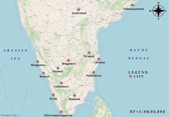
- The map uses a Representative Fraction (RF) scale of , meaning on the map represents on the ground.
- To find actual geographical distances:
- Convert the scale from centimeters to kilometers (, ).
- Measure the map distance between two cities with a ruler.
- Multiply the measured map distance by the scale factor in .
(i) Find the geographical distance between Bengaluru and Chennai.
Step 1 · Convert the Map Scale to km/cm
Given scale ratio is .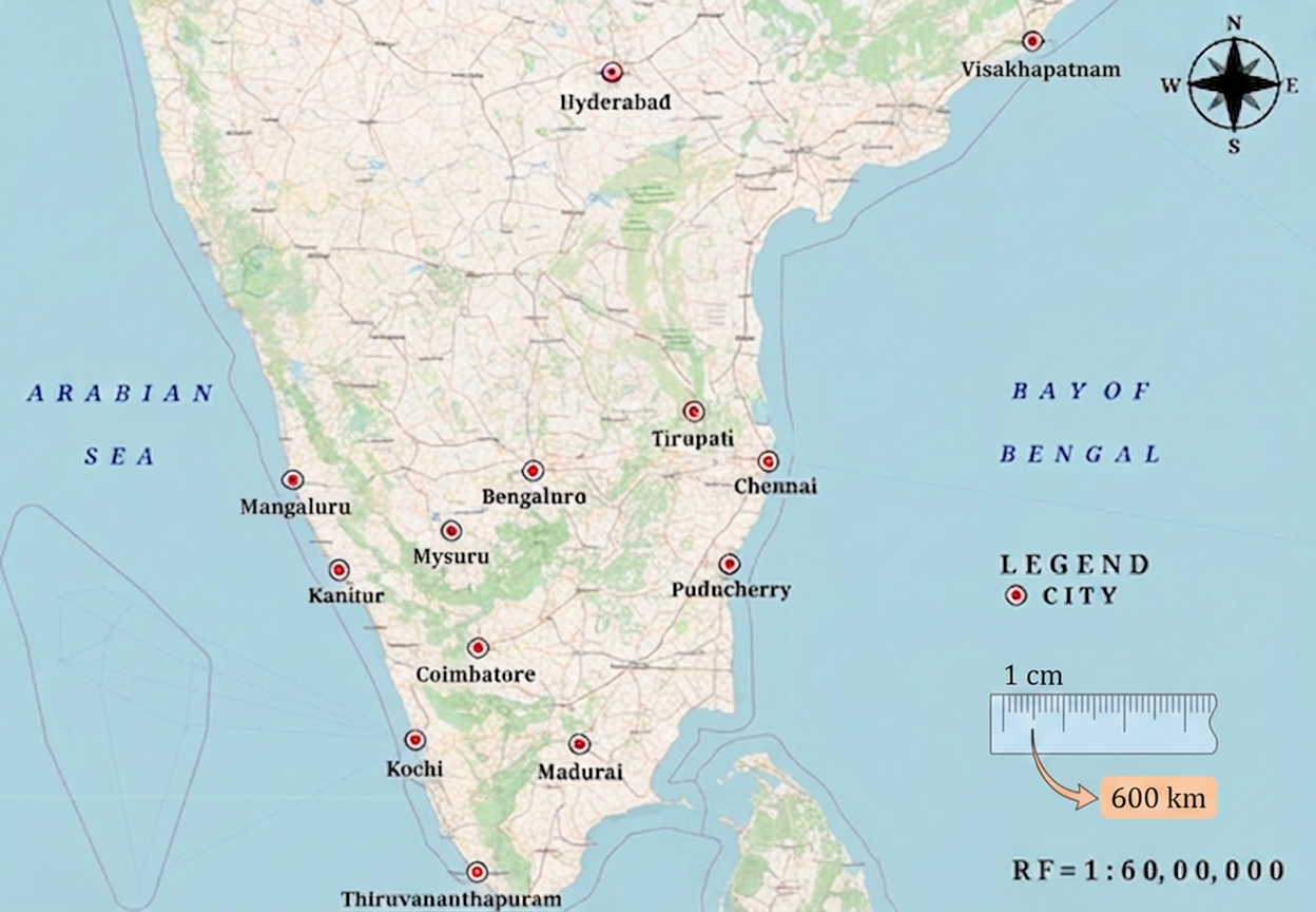
Step 2 · Calculate Distance between Bengaluru and Chennai
Measured map distance between Bengaluru and Chennai:
Actual geographical distance:
(i)
(ii) Find the geographical distance between Mangaluru and Chennai.
Step 1 · Calculate Distance between Mangaluru and Chennai
Measured map distance between Mangaluru and Chennai:
Actual geographical distance:
(ii)
- Unit Conversion Errors: Forgetting that (), leading to incorrect division by or only.
- Ruler Measurement Errors: Misreading centimeters/millimeters when measuring straight-line distance between the city points on the map.
More questions in IT
Viswanath made idlis by mixing 6 cups of rice with 3 cups of urad dal, while Puneet made idlis by mixing 4 cups of rice with 2 cups of urad dal. If cooked in the same way, would their idlis taste the same?
Have you noticed that in many maps there is a ratio given, usually in the lower right corner of the map? It usually contains and a very large number, such as . What does mean? What does it indicate? Can you guess?
Convert to kilometres.
It is . Verify this.
Using the map above, can you find the geographical distance between Bengaluru and Chennai? Also, find the geographical distance between Mangaluru and Chennai.
[Hint: Use a ruler to find the distance between the cities on the map. Then, use the ratio given on the map to find the actual geographical distance.]
Try to find the distances between the same two pairs of cities with different maps that have different scales (ratios). Do they all give the same geographical distance, approximately?
Context: Puneeth's father went from Lucknow to Kanpur in 3 hours by riding his motorcycle at a speed of 30 km/h. If he takes a car instead and drives at 60 km/h, how long will it take him to reach Kanpur?
Q. Can we represent this problem with the following statement of proportionality — ? Will the travel time increase or decrease as the speed of the motorcycle increases?