Question 5
Try to find the distances between the same two pairs of cities with different maps that have different scales (ratios). Do they all give the same geographical distance, approximately?
- A map scale represents the ratio between the distance on a map and the actual distance on the ground.
- Formula:
- Even though different maps with different scales show different measured distances on paper for the same two cities, multiplying each map distance by its respective scale factor yields the same actual geographical distance (approximately, accounting for slight measurement error).
Step 1 · Measure Map Distances for Two Scales
Consider two maps showing the distance between the same two cities (Delhi and Jaipur):
- Map A: Scale is
- Map B: Scale is
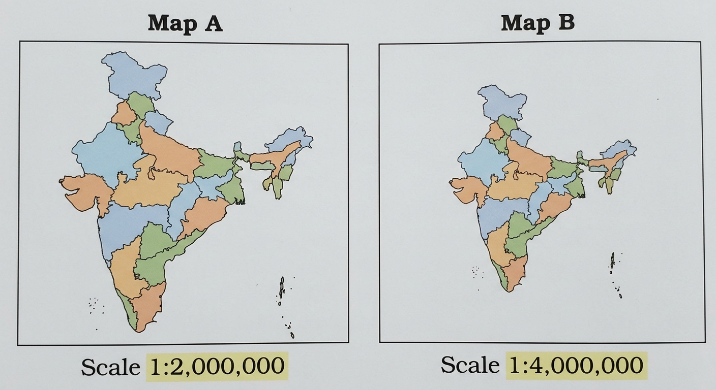
Measuring the straight-line distance between the cities on each map:
- Distance on Map A ()
- Distance on Map B ()
Step 2 · Calculate Actual Geographical Distances
Using the formula:
For Map A:
Converting to kilometers ():
For Map B:
Converting to kilometers:
Step 3 · Compare the Calculated Distances
Comparing the results:
- Actual distance from Map A
- Actual distance from Map B
Both calculations yield the same actual geographical distance.
Yes, they all give the same geographical distance, approximately.
- Unit Conversion Error: Forgetting to convert centimeters to kilometers (). Leaving the answer in centimeters can lead to confusion.
- Operation Inversion: Dividing by the scale factor instead of multiplying when converting from map distance to actual real-world distance.
More questions in IT
Viswanath made idlis by mixing 6 cups of rice with 3 cups of urad dal, while Puneet made idlis by mixing 4 cups of rice with 2 cups of urad dal. If cooked in the same way, would their idlis taste the same?
Have you noticed that in many maps there is a ratio given, usually in the lower right corner of the map? It usually contains and a very large number, such as . What does mean? What does it indicate? Can you guess?
Convert to kilometres.
It is . Verify this.
Using the map above, can you find the geographical distance between Bengaluru and Chennai? Also, find the geographical distance between Mangaluru and Chennai.
[Hint: Use a ruler to find the distance between the cities on the map. Then, use the ratio given on the map to find the actual geographical distance.]
Try to find the distances between the same two pairs of cities with different maps that have different scales (ratios). Do they all give the same geographical distance, approximately?
Context: Puneeth's father went from Lucknow to Kanpur in 3 hours by riding his motorcycle at a speed of 30 km/h. If he takes a car instead and drives at 60 km/h, how long will it take him to reach Kanpur?
Q. Can we represent this problem with the following statement of proportionality — ? Will the travel time increase or decrease as the speed of the motorcycle increases?